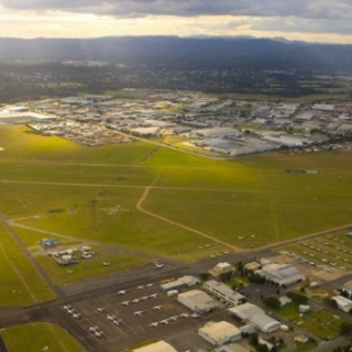
A reference group representing the local community of Warwick had agreed upon a two kilometre wide corridor within which the power line could be installed. The corridor was located within the vicinity of Warwick Aerodrome.
Aviation Projects was engaged by Ergon Energy to define the areas within the two kilometre corridor in which a structure with a height of 25 metres above the ground could be installed, without infringing the future Obstacle Limitation Surfaces (OLS) for Warwick Aerodrome.
We did this using Geographical Information System (GIS) software by designing the future obstacle limitation surfaces and incorporating terrain elevation data then determining those areas where there was less than 25 metres in height between the terrain and the most limiting surface of the (OLS).

